Derry Inner Waterside: Reconnecting a Riverfront Neighbourhood
This public realm audit and strategic plan for Derry Inner Waterside presents eight strategic proposals to improve the urban environment, pedestrian experience and quality of public spaces in this part of the city on the east side of the river Foyle.
-
Client: Derry City + Strabane District Council
Advice: DfI
Collaborator: MMAS
This public realm audit and concept plan was commissioned by the Derry City & Strabane District Council Regeneration Section. The team were invited to look at the Inner Waterside through the lens of pedestrian experience and quality of public realm, identifying key issues along with priorities and actions to make meaningful improvements.
It became clear that changes in infrastructure over the past half century or more have had a very significant effect. In order to understand the impact of this, the team also assessed how urban connections have changed over the years through exploring the historic version of the city in photos, maps and written accounts, alongside our analysis of the present day conditions.
What has come out of this research is a series of strategic proposals which can be developed in the short, medium and long term:
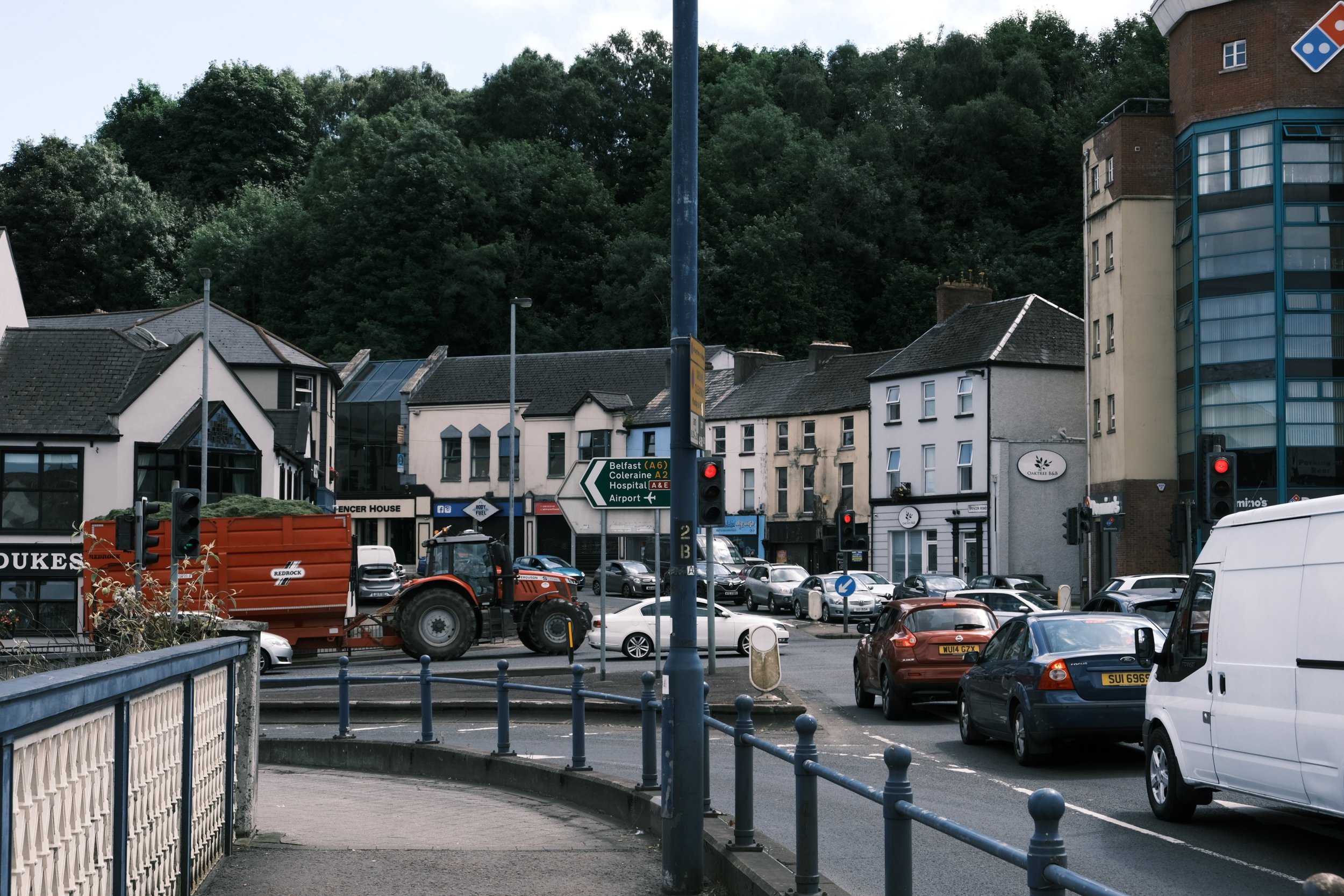
Craigavon Bridge Junction
Train Station Junction
King Street Junction
Spencer Road
Lower Fountain Hill connection
Duke Street residential neighbourhood
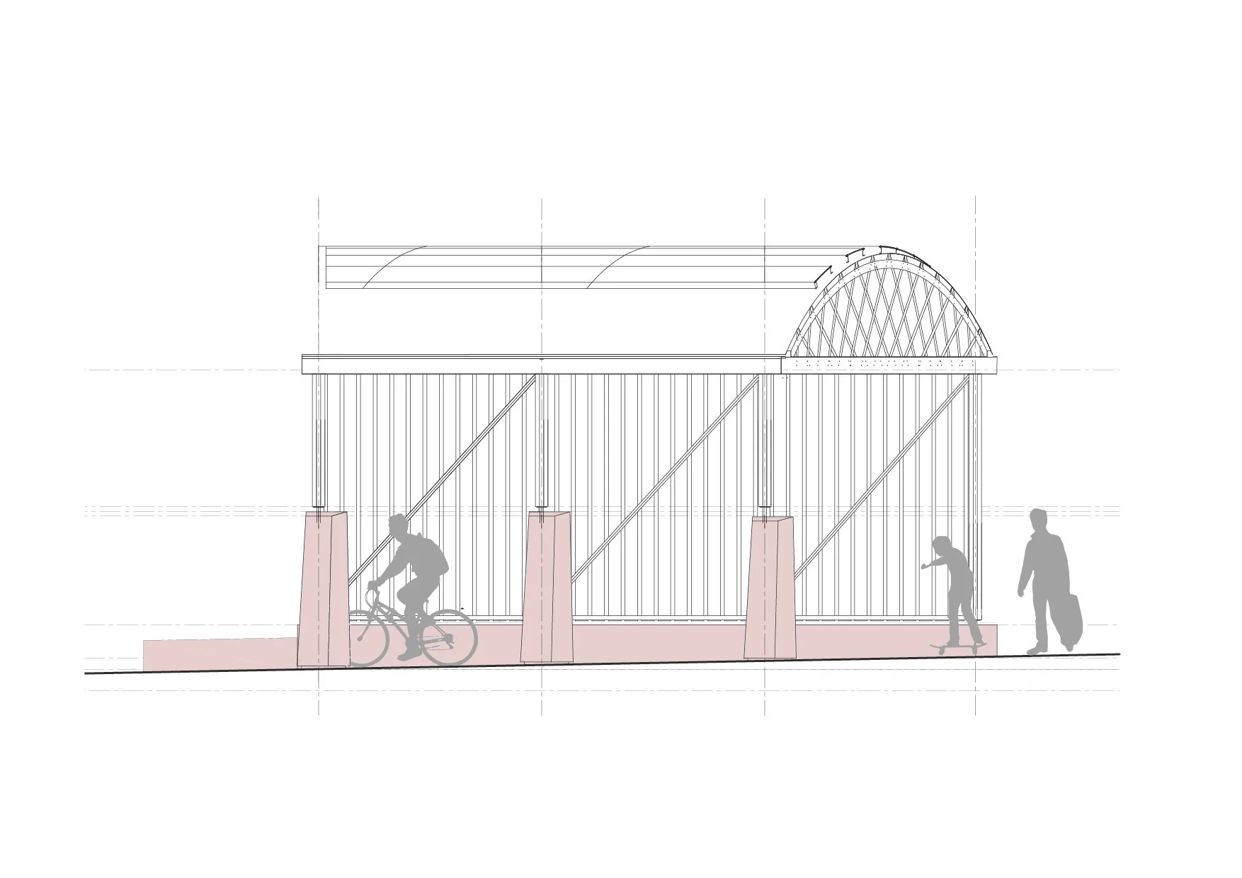
Embankment park and Greenway
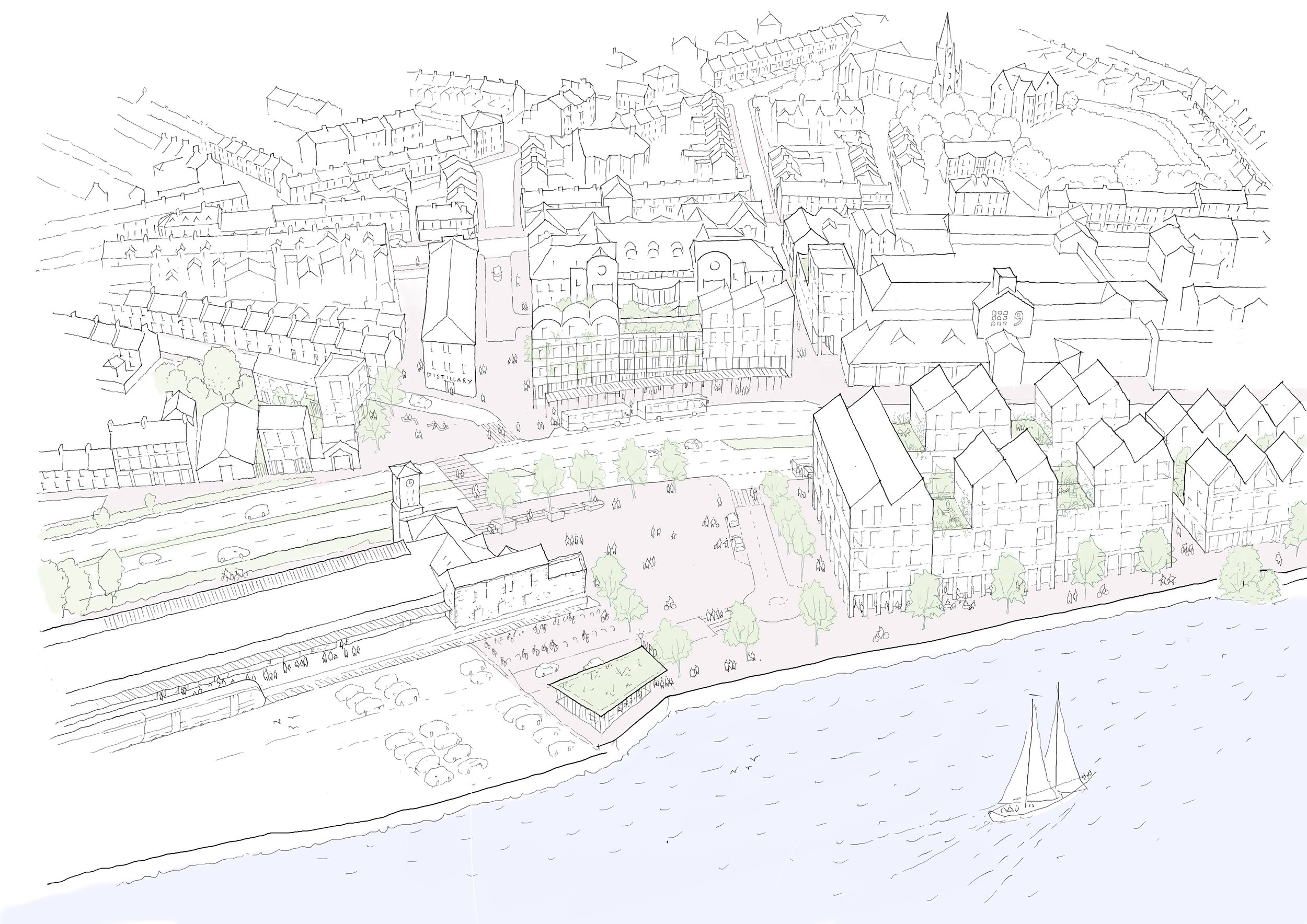
Reconnecting with water
These 8 proposals look to address the significant public realm issues which exist;
Re-establishing connections to the wider city
Re-establishing connections to transport, industry and the working river edge
Create an active river frontage – an active river edge will bring life to Duke Street and neighbourhood beyond
Prioritising pedestrian movements between both sides of the city
Re-establishing active frontages making for lively & walkable neighbourhoods
Safer crossings and more pleasant neighbourhood streets
Establishing new green space for residents
Improved connections to the Foyle to benefit quality of life & well-being of Inner Waterside residents

Image Above: The Inner Waterside Area is disconnected from the water’s edge
Impact
The team collaborated with the Department for Infrastructure to develop detailed, deliverable proposals
This strategic plan currently being considered by DCSDC. It is hoped that this will influence progressive planning policy around neighbourhood renewal in the city and inform the new Local Development Plan.
Conversations with business clusters in the area have taken place to kickstart proactive moves toward achieving aspects of the plan with the local community.


Process
Urban Analysis:
The strategic urban plan was developed over two stages. Stage 1 involved research and needs-based analysis using the following processes:
• Site visits and audits
• Historical and heritage analysis
• Stakeholder interviews
• Local business consultations
• Field studies
• Evidence based research
• Review of national and regional policies
• Precedent analysis
Stage 2 involved propositional design thinking informed by collaborative workshops with the DfI and DCSDC team.